

Applications of Laser Ranging Technology in the Drone Industry
How Laser Distance Measurement Is Making Modern Drones Smarter and Safer
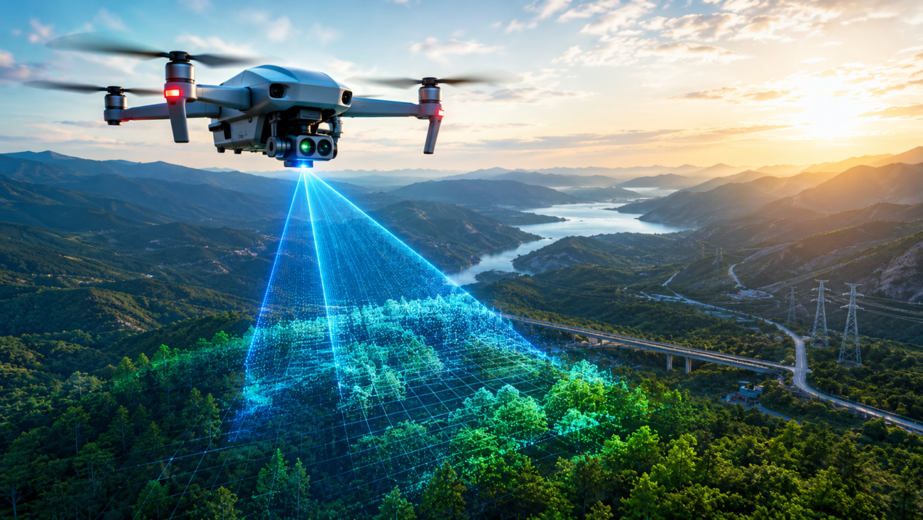
Quick answer: laser ranging gives drones accurate real-time spatial awareness — obstacle detection, altitude measurement, navigation, and 3D mapping — which is why it is becoming a core technology for safer, more intelligent drones.
In recent years, drone technology has developed at an astonishing pace. What once started as a tool mainly for aerial photography has now expanded into industries such as agriculture, logistics, mapping, infrastructure inspection, emergency rescue, environmental monitoring, and intelligent transportation.
Behind this rapid evolution, one important technology is playing an increasingly critical role: laser ranging technology.
Modern drones are no longer simply “flying cameras.” To operate safely and intelligently, drones must understand the world around them in real time. Laser ranging technology provides this essential spatial awareness capability.
In simple terms, laser ranging gives drones a highly accurate “sense of distance,” allowing them to detect obstacles, measure altitude, navigate complex environments, and build detailed 3D maps.
As artificial intelligence and autonomous flight continue to advance, laser ranging technology is becoming one of the core foundations of the next generation of intelligent drones.
What Is Laser Ranging Technology?
Laser ranging refers to the use of laser beams to measure the distance between objects.
A drone equipped with a laser sensor emits laser pulses toward surrounding objects. When the laser beam reflects back, the system analyzes the returned signal to calculate the exact distance between the drone and the target.
Compared with traditional distance measurement methods, laser ranging offers several major advantages:
High measurement accuracy
Fast response speed
Long detection range
Strong resistance to environmental interference
Excellent 3D sensing capability
Because of these advantages, laser ranging has become an essential technology in modern drone systems.
Why Drones Need Laser Ranging Technology
One of the most important tasks for any drone is understanding its surrounding environment.
During flight, drones constantly need to determine:
How high they are above the ground
Whether obstacles exist ahead
The distance to nearby buildings or objects
Whether the flight route is safe
Where and how to land safely
Without accurate distance sensing, drones would face a much higher risk of collision or unstable flight.
This becomes especially important in complex environments such as:
Urban areas with tall buildings
Forests and mountains
Indoor spaces
Nighttime operations
Low-visibility environments with smoke or fog
Traditional cameras alone often struggle under these conditions, while laser ranging systems can still provide highly accurate spatial information.
As a result, laser ranging technology is becoming one of the key building blocks of autonomous drone navigation.
Main Applications of Laser Ranging in Drones
1. Obstacle Avoidance Systems
Obstacle avoidance is one of the most common and important applications of laser ranging in drones.
Modern drones increasingly rely on intelligent collision avoidance systems to improve flight safety.
During flight, laser sensors continuously scan the surrounding environment. When the system detects objects such as:
Trees
Buildings
Power lines
Bridges
Other aircraft
the drone can instantly calculate safe distances and automatically adjust its flight path.
This capability is particularly important for low-altitude flight in crowded urban environments.
Unlike traditional cameras, laser ranging systems can accurately determine real spatial distances even in difficult lighting conditions.
Today, many advanced consumer drones already include multi-directional laser-based obstacle avoidance systems.
Future systems are expected to become even more intelligent and reliable.
2. Precision Altitude Control and Stable Flight
Drones must constantly know their exact height above the ground in order to maintain stable flight.
This is especially important during:
Low-altitude hovering
Indoor navigation
Automatic landing
Terrain-following flight
Laser ranging systems can rapidly and accurately measure the distance between the drone and the ground surface.
Compared with traditional solutions such as barometers or ultrasonic sensors, laser systems usually provide:
Higher precision
Faster response times
More stable performance
This allows drones to hover more smoothly and maintain better flight stability.
Many modern aerial photography drones achieve highly stable low-altitude flight thanks to laser altitude sensing technology.
In the future, drones may achieve even more precise altitude control with centimeter-level accuracy.
3. LiDAR Mapping and 3D Surveying
One of the most powerful applications of laser technology in drones is LiDAR mapping.
LiDAR, which stands for Light Detection and Ranging, is essentially an advanced laser scanning system capable of creating detailed three-dimensional environmental models.
When mounted on drones, LiDAR systems can quickly generate highly accurate 3D maps.
Compared with traditional aerial photography mapping, LiDAR offers several advantages:
Higher precision
Better performance under poor lighting
Ability to penetrate vegetation
More accurate terrain reconstruction
Because of these advantages, drone-mounted LiDAR systems are widely used in:
Topographic surveying
Smart city modeling
Forestry analysis
Mining operations
Highway planning
River monitoring
Infrastructure construction
For example, in forest environments, traditional cameras often capture only the tops of trees, while LiDAR systems can partially penetrate vegetation and reveal the ground surface beneath.
This capability is extremely valuable for geographic surveying and environmental analysis.
Today, professional mapping drones increasingly rely on high-performance LiDAR systems.
4. Power Line Inspection and Industrial Monitoring
Drones are rapidly becoming important tools for industrial inspection tasks.
Applications include:
High-voltage power line inspection
Wind turbine monitoring
Oil and gas pipeline inspection
Bridge structure analysis
Railway system monitoring
Traditional manual inspection methods are often dangerous, expensive, and time-consuming.
By combining drones with laser ranging systems, companies can perform inspections more safely and efficiently.
Laser sensors help drones:
Maintain safe operating distances
Navigate around complex structures
Detect equipment deformation
Generate detailed 3D inspection models
In power grid inspection, for example, laser ranging systems can help drones avoid dangerous collisions with high-voltage cables.
As automation technology improves, industrial inspection drones are expected to become even more autonomous.
5. Drone Delivery and Autonomous Navigation
Drone delivery services have become one of the hottest areas of development in recent years.
However, delivery drones face a major challenge: operating safely in crowded and unpredictable urban environments.
Drones must detect and avoid:
Buildings
Electrical wires
Trees
Vehicles
Pedestrians
Laser ranging systems allow drones to build real-time spatial maps of their surroundings.
Future delivery drones may rely heavily on laser sensing for:
Autonomous route planning
Intelligent obstacle avoidance
Precision landing
Real-time path optimization
This technology is expected to become an important foundation for the future low-altitude economy.
Why Laser Ranging Is More Important Than Cameras Alone
Many people wonder why drones need laser ranging systems if they already have cameras.
The answer is simple:
Cameras help drones “see,” while laser ranging helps drones “understand distance.”
Although cameras capture visual information, they do not always provide reliable spatial measurements.
In challenging conditions such as:
Darkness
Strong backlighting
Fog and rain
Complex backgrounds
Repetitive textures
camera-based systems may struggle.
Laser ranging systems directly measure physical distance, making them more reliable for precise navigation and obstacle detection.
In the future, advanced drones will likely combine multiple sensing technologies, including:
Cameras
LiDAR
Radar
Ultrasonic sensors
Artificial intelligence algorithms
Together, these technologies will create highly intelligent environmental perception systems.
Challenges Facing Laser Ranging Technology
Although laser ranging offers major advantages, the technology still faces several challenges.
Cost
High-performance LiDAR systems can still be relatively expensive, especially for consumer drones.
However, prices are gradually decreasing as production scales grow.
Weather Conditions
Heavy rain, fog, dust, and snow can interfere with laser propagation.
Future systems will need stronger environmental adaptability and signal processing capabilities.
Power Consumption
Laser systems often consume significant power.
Since drones rely on battery operation, reducing energy consumption remains a key technical challenge.
Future low-power laser solutions will become increasingly important.
Future Development Trends
The future of laser ranging technology in drones is expected to move in several major directions.
Smaller and Lighter Systems
Laser sensors will continue to become more compact and easier to integrate into lightweight drones.
Smarter Autonomous Systems
Artificial intelligence will increasingly combine with laser sensing to improve autonomous decision-making.
Lower Costs
As production expands, laser modules will become more affordable for consumer-level drones.
Higher Accuracy
Future drones will achieve more advanced spatial perception capabilities with extremely precise measurement performance.
Multi-Sensor Fusion
Laser ranging technology will increasingly work together with cameras, radar, and AI systems to create more reliable environmental awareness.
How Laser Ranging Will Transform the Drone Industry
In many ways, laser ranging technology is helping drones evolve from simple remote-controlled aircraft into intelligent flying robots.
Future drones may be capable of:
Autonomous patrol operations
Automatic obstacle avoidance
Real-time 3D mapping
Intelligent delivery services
Automated rescue missions
Infrastructure fault detection
All of these capabilities rely heavily on accurate spatial perception.
Laser ranging technology is one of the most important technologies making this transformation possible.
Conclusion
As artificial intelligence, robotics, and low-altitude aviation continue to develop, drones are entering a new era of intelligent autonomous flight.
Laser ranging technology provides drones with the critical ability to understand and interact with the physical world.
From obstacle avoidance and precision navigation to LiDAR mapping and industrial inspection, laser ranging is continuously expanding the capabilities of modern drones.
In the future, drones will not only fly farther and safer, but also become significantly smarter.
And behind this intelligent flight revolution, laser ranging technology will likely remain one of the most essential core technologies driving the industry forward.
Featured Products